The biggest salt deposit in the world, the"Uyuni Salt Deposit", is located to the southwest of Bolivia. The salt crust covers a surface of 10.582 Km2 of extension, at an altitude of 3.653 meters above sea level, as if it were a static sea caressed by the southern winds.
This semidesert volcanic land region, encloses extremely beautiful natural resources characterized by one outstanding constant: the color. The Uyuni Salt Deposit and Laguna Colorada (Red), Laguna Verde (Green), Laguna Amarilla (Yellow), and Laguna Celeste (Sky-Blue) are the best indicators. Their names are due to their different shades of color as a result of the algae contained therein, such as the phytoplankton (dunallella-type algae), and the movement of the wind at a particular time of the day.
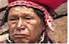
There are also geysers, rock formations, and volcanic wells that go back to the times when the earth was formed. Along the road there are towns with different traditions and customs belonging to Quechua groups settled in these high and semiarid lands.
Tourist Attractions
Town of Uyuni
This town holds the rests of the most important railway machinery dating back to 1890, as can be appreciated in the local repair shops known as "The Train Cemetery". 22 Km away from this town there is Pulacayo, which was a very important producer of silver by the end of the 19th Century. Pulacayo is the seat where the worldwide known "Thesis of Pulacayo" was proclaimed, which recognized the rights of the worker class in Bolivia. It is also possible to see the first train that run in Bolivia and other trains that were robbed by famous American villains such as Butch Cassidy and Sundance Kid.
Colchani
The town of Colchani stands on the shore of the Great Salt Deposit, 22 Km north of the city of Uyuni. Also known as "Puerto Seco", it serves as main access to the intense salt extraction rudimentary activity observed in this area. The railway network that crosses the town from north to south had great influence on the economy of the region because of the large amounts of salt that were transported on the freight cars to the urban centers. The visitor will be able to appreciate the rural houses made of adobe walls and salt blocks and roofed with wild grass or ichu. These materials contribute to maintain a warm temperature indoors and help to bear the low temperatures that prevail throughout the year.
The presence of wild grass or ichu in the region makes this a good pastureland for llamas, vicuñas and other mammals.
Uyuni Salt Deposit
This salt deposit is made up of a very pure, 6 m deep, saliferous stratum that was the result of the disapperance of a sea, which occurred 13.000 years ago, that covered the entire Bolivian Altiplano up to the Titikaka lake.
It goes from north to south, in the southwest region of the national territory, between parallels 20º and 21º south latitude and 68º west longitude. It comprises a reserve of 9 million tons of lithium and other evaporative minerals.
Multiple "eyes" may be found in the Salt Deposit, created by the salty waters of what used to be the Tauca lake. They have a diameter of 10 to 15 cm and a depth of up to 120 meters, and the biggest ones may be 3x2 meters.
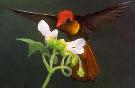
This amazing ecosystem shelters an interesting regional fauna such as Soca Cornuda and the extraordinary James flamingo, which coexists with the Andean and Chilean flamingo species. The Eduardo Avaroa Andean Fauna National Reserve is the best place for these species to built their nests. This is also the habitat of the "Suri", an endangered species, and other mammals such as vicuñas, llamas, and Andean cats and foxes.
The flora is characterized by the strong presence of grammineae (wild grass or ichu), and tholares and keñuas can be found in humid areas.
Driving through this salt lake is an extraordinary experience, especially in wintertime, when the deep blue of the sky contrasts with the brilliant white of the salty crust. When it is cloudy, the "white-out" effect occurs, and the horizon fades out until disappearing, being almost impossible to distinguish between land and sky.
Polyhedral shapes formed by the eolian force of the wind are found amidst this spectacular landscape. Visitors are marvelled with these strong contrasts right in front of their eyes, like a masterpiece combining the shiny white of the desert, the deep blue of the sky, the wild brownish shades of the surrounding mountains and the islandsscattered throughout this scenery.
Isla Pescado
The Cujiri Island, better known as Isla Pescado (Fish Island) is located 74 Km from Colchani, in the very center of the salt deposit. It has an extension of 100 hectares and reveals a colorful landscape.
The surface of granite and organic land allowed a giant species of cactus, approximately 6 meters high, to develop an interesting ecosystem.
The island also exhibits some geological formations that are of great attraction for scientific research.
A cave located on the top allows to see different geological layers of the soil; besides, this is one of the best places to take pictures of the island and of the salt deposit.
Some parts of the island exhibit white and pink colored layers which make it more attractive; the cave located near the top of the island allows to see the different geological layers of the soil, and this is one of the best places to take pictures of the island and of the salt deposit.
Incahuasi Island
Known as Isla Pescadores (Fishermen Island), this island encloses a cactus forest (quirucolumbar, pillaya, piscallu, thulo, huajraguaya, añaguaya, etc.). The island is formed on the rests of a volcano, composed of petrified limestone along 1943 m and an altitude of 102 m above the surface of the salt deposit. 7 Tiwanakota-type archaeological sites, 2 Inca ruins, 30 caverns and 12 natural tunnels are found in this island. Alfredo Lázaro (living in the community of Llica) protects the island since 1987, and keeps record of 4030 adult cactuses, 5000 cactus units under development and 16 burnt or dried cactuses. The island is a nest for birds, viscachas, baker birds (Furnarius rufus), etc.
This is an excellent setting to take pictures and gaze at the landscape of the Uyuni Salt Deposit.
"Eduardo Avaroa" Andean Fauna National Reserve (REA)
The "Eduardo Avaroa" Andean Fauna National Reserve is located south of the Uyuni Salt Deposit. It encloses extraordinary lagoons, a huge diversity of flora and geysers and geothermal wells of amazing shapes covering an area of 7.147 Km.
The REA was created in 1973, and it covers an area of 714.745 has. (7.147 km2.). It is located at the South end of the Department of Potosí, in the Province of Sud Lípez, Municipality of San Pablo de Lípez. The area is bounded by the Republic of Argentina to the south and by the Republic of Chile to the west. The weather is very cold and dry, with annual rainfall less than 100 mm. The altitude ranges between 4.200 and 6.000 meters above sea level. The Reserve Eduardo Avaroa (REA) covers the physiographic region of the Western or Volcanic Cordillera, characterized by broad plateaus and volcanic cones.
It shelters 102 species of flora, and approximately 200 species of upper plants have been recorded. Ecologically, it is characterized by broad icy deserts and semidesert highland prairies. It encloses salty lagoons of glacial origin, sedge swamps (bofedales) and peat bogs. 96 species of fauna have been recorded, the most outstanding species being the vicuña (Vicugna vicugna), Andean cat or titi (Felis jacobita), suri (Pterocnemia pennata), soca (Fulica cornuta), chocka (Fulica gigantea) and three flamingo species (Phoenicoparrus andinus, Phoenicoparrus jamesi and Phoenicopterus chilensis) that built their nests in enormous colonies. Likewise, there are some species of small birds such as Upucerthia validirostris, Phegornis mitchelli and other migratory species that come from the Northern hemisphere.
Árbol de Piedra (Stone Tree)
This is a complex of rocky formations, the evolution and shape of which are due to the eolian erosion, creating natural landscape scenes of surrealistic effect. It is surrounded by a desert sand landscape, and it is an excellent place to gaze at Mother Nature's masterpieces of ravishing forms and shapes.
Laguna Colorada (Red Lagoon)
This lagoon is located west of the department, at 4.278 meters above sea level, covering an area of 60 km2. It is a multicolored lagoon wherein the reddish shades prevail. The red color of the waters is due to sediments of zooplankton, phytoplankton and others, which produce a colorful contrast between the surroundings, the flamingoes and the red of the lagoon.
It is also called the "Nest of the Andes", since it shelters more than 30.000 flamingoes of three different species that build their nests there and make this lagoon one of the best zones in the world for watching the flamingoes. It also shelters the largest population of Parihuana Chica in South America.
The landscape becomes even more spectacular because of the birds that settle on the red waters. There are three types, namely, Puna flamingo or Chururu, totoko and Andean parina. These birds stop here before continuing their way to the north.
The road to Laguna Colorada passes by the active Ollagüe volcano and the chain of lagoons where the flamingoes live. Nearby, in between the lagoons, there are the thermal waters of Chalviri, containing salty water at a temperature of 30º C.
In this sector, you can also see tourist spots such as the lagoons Chiar Ckota, Hedionda, Ramaditas and Salada lagoons, the Ollagüe and Llicancabur hills, the rocky formations of Jara Pampa, and the thermal power of Sol de Mañana (Morning Sun).
Sol de Mañana (Morning Sun)
Located one hour away from Colorada lagoon, this place encloses geysers, intermitent springs of water that emerge at 90°C and fumaroles, which are cracks through which volcanic lava comes out. For this reason, this must be watched some distance away because of the terrain sensitivity.
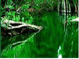
Laguna Verde (Green Lagoon)
It is located at the southwest end of Potosí, at the feet of Llicancabur volcano, at an altitude of 4.350 meters above sea level, and covers an area of 17 km2. Gazing at this makes one think of the end of the world. It is divided into two bodies of water, and its extraordinary color is due to the high content of magnesium of the geological formations of the region. The main attraction occurs when the sun gets to the zenith.
The shore of this impressive lagoon is spotted with enormous black volcanic stones and saline rocks that emerge from inside the earth.
The depth of this lagoon has not been determined yet, its banks are interesting because of the existing formations and its widely spaced beaches. The flora is composed of wild grass or ichu that grows following the direction and intensity of the wind.
The most picturesque places are its banks, with spectacular panoramic views of the lagoon and the surrounding hills, forming a colorful contrast that is reflected by the water mirror of the lagoon.
Some of the activities that can be carried out are trekking, adventure tourism and ecotourism. Visits should preferably be made during June, July and August, when the land is dry and early ascents can be made departing from the forest ranger lodgings.
The Llicancabur volcano is now extinct and is located on the western region of Laguna Verde (Green Lagoon), at an altitude of 5.868 meters above sea level, and marks the border between Chile and Bolivia.
The ascent to the top takes about 5 hours, and 5 hours more to go down because of its steep rocky slope and the strong winds that sometimes blow at a rate greater than 100 Km per hour.
It has an almost perfect conical shape, and due to its height there is very scarce vegetation made up of wild grass or ichu and grammineae that grow at ground level.
From the top of this interesting volcano, one can feel the strong winds coming from the Pacific Ocean, in addition to gazing at the panoramic views of the deep valleys and various lagoons existing in the park and its surroundings. |


