PRESENTATION
Although no one says no to a casual meander along its grand urban boulevards, travelers are drawn to this string bean of a country because ofits spectacular Pacific coastline and Andean highlands, and because of the opportunities it offers for adventure sports. Chile's distinctive culture has survived the violence and repression of its recent history and is thriving once again thanks to a people noted for their warmth and resilience.
Despite having the most European community in South America, indigenous traditions persist in the Andean foothills and in the southern plains, while some of South America's finest national parks draw trekkers and guanaco spotters alike.
FACTS
Full country name: Republic of Chile
Area: 756,950 sq km (292,500 sq mi)
Population: 15 million (growth rate 1.2%)
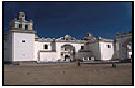
Capital city: Santiago (pop 5,000,000)
People: 95% European descent and mestizo, 5% Indian
Language: Spanish and a handful of native languages, including Aymara, Mapuche and Rapa Nui
Religion: 89% Roman Catholic, 10% Protestant, less than 1% Jewish
Population density:20 persons per square kilometer
Urbanization: Urban: 84% Rural:16% (1997)
Life expectancy: 75.2 years (1998)
Literacy rate: 95.2 percent (1995)
Government: Republic
President: Ricardo Lagos
GDP: US$184 billion
GDP per capita: US$12,500
Annual growth: 3.5%
Inflation: 4.5%
Major industries: Copper, fishmeal, wine
Major trading partners: USA, Japan, Germany, UK
TRAVEL INFORMATION
Visas: Citizens of the USA, Canada, Australia and most Western European countries do not require a visa although US citizens do pay a US$20 levy; New Zealanders do need one. A 90-day entry permit, renewable for another 90 days, is received on entering the country.
Health risks: Cholera
Time: GMT/UTC minus 4 hours
Electricity: 220V, 50 Hz
Weights & measures: Metric
When to Go
Chile's geographical variety can make a visit rewarding in any season. Santiago and Middle Chile are best in the verdant spring (September through November) or during the fall harvest (late February into April), while popular natural attractions like Parque Nacional del Paine in Magallanes and the lakes region are best in summer (December through March). Conversely, Chilean ski resorts draw many foreigners during the northern summer (June through August). Easter Island is cooler, slightly cheaper and much less crowded outside the summer months. The same is true of the Juan Fernandez archipelago, which can be inaccessible if winter rains erode the dirt airstrip; March is an ideal time for a visit.
LAND & CLIMATE
Region: South America
Neighbors: Chile shares a border with Peru on the far north, Bolivia on the northeast, and Argentina on the east. The Pacific Ocean lies to the south and west.
Size Comparison: About twice the size of Japan
Physical Features
Chile has an extreme north-south length of approximately 4,300 kilometers (about 2,672 miles), but its average width is less than 180 kilometers (less than 112 miles), and nowhere is it more than 356 kilometers (221 miles) wide. Archipelagoes belonging to Chile extend along the southern Chilean coast from Isla de Chiloé to Cape Horn.
The Andes dominate the Chilean landscape. The mountain system extends the entire length of the narrow country, from the Altiplano plateau in the north to Tierra del Fuego in the south. Longitudinally, Chile features three topographic zones: the lofty Andean cordillera on the east, the low coastal mountains on the west, and a plateau area separating the two ranges. In latitude, three major geographical regions can be distinguished: the northern, central, and southern regions.
The ranges of the Andes are widest in the northern region, forming broad plateaus. Many mountains here have elevations in excess of 6,100 meters (20,013 feet). The dry Atacama Desert, with its vast nitrate fields and rich mineral deposits, is situated in the plateau area.
The central region's plateau includes the fertile Central Valley, which is about 965 kilometers (about 600 miles) long and forms the agricultural heartland of Chile. The central Andes are narrower in width and have lower elevations than those in the north. Exceptional natural harbors are located in this region in Bahía Concepción.
The long chains of islands along the southern coast, which is indented by numerous fjords, are formed by the peaks of submerged coastal mountains. Elevations in the southern Andes seldom exceed 1,830 meters (6,004 feet). Chile lies in a zone of geologic instability and is subject to earthquakes and volcanic activity.
Major Rivers and Lakes
Some of Chile's most important rivers, from north to south, include the Loa, Aconcagua, Maipo, Maule, and Biobío, all of which empty into the Pacific. The rivers are vital for the irrigation waters and hydroelectric power they provide. Cascades, however, limit navigation.
A scenic district of southern Chile is home to many of the country's major lakes.
Weather and Climate
Chile's great latitudinal range means a diversity of climates. The country benefits from oceanic influences that generally moderate temperatures. The mostly desert northern region is one of the driest areas in the world, but the cold, offshore Humboldt Current, or Peru Current, keeps temperatures low. The average annual temperature at Antofagasta is 17°C (63°F). Compare this to parts of the Sahara of northern Africa, where temperatures can exceed 49°C (120°F).
Temperatures decrease about 1°C for each 150 meters (about 1°F for each 275 feet) of elevation in the Andes. Rainfall increases southward, and the central region enjoys a Mediterranean-like climate. Precipitation here is concentrated in the winter months (May to August) and ranges from 300 millimeters (12 inches) annually at Santiago to 1,270 millimeters (50 inches) at Concepción. Mild winters and relatively cool summers are found in the central region; the average annual temperature at Santiago is 14°C (57°F). The cooler southern region experiences year-round rainfall. Precipitation reaches a maximum of about 5,000 millimeters (about 200 inches) near the Strait of Magellan. The average annual temperature at Punta Arenas is 6°C (43°F). Cyclones are common in the southern region.
Environmental Issues
Chile is remarkable in that it spans 39 degrees of latitude and includes 83 distinct vegetation types. Its varied ecosystems include the Atacama Desert, ancient beech forests, and fjords and glaciers of the southern Andes. Nearly two-thirds of the population lives in the fertile region surrounding Santiago. This high concentration of people has led to severe environmental deterioration in this area. Many water systems are polluted with sewage, and urban air pollution is severe. Automobile ownership has increased 10 percent annually in recent years, prompting the government to establish a complex management plan with strict emission standards and a modernized public transportation system.
Chile is 10.5 percent (1995) forested. Natural forests, especially temperate rain forests, are being harvested at a high rate, mostly in the south by foreign companies. The native trees are being replaced with extensive plantations, so the total forest cover is actually increasing, although at the expense of natural biodiversity. Soil erosion is widespread, and desertification in some areas is significant. Chile is one of the largest marine-fishing nations in the world. The fishing industry has doubled in size since 1980 but harvests have declined in recent years because of unsustainable catch rates. Chile's ocean salmon-netting techniques are thought to exclude dolphins from natural habitat, and fish farms have recently polluted inland waterways with phosphate-based fish food and antibiotics. Chile takes advantage of the rich ocean life supported by ocean upwelling off the west coast of South America, but this is interrupted every few years by the El Niño current, which brings unusually wet weather to the land.
Chile has an extensive protected area system made up of 30 national parks, 36 national reserves, and 10 natural monuments, but it excludes many important ectoypes, especially those of the central and northern regions. Overall, about 18.9 percent (1997) of the country is protected. There is one designated wetland under the Ramsar Convention on Wetlands, and seven biosphere reserves under the United Nations Educational, Scientific and Cultural Organization (UNESCO) Man and the Biosphere Program. Chile's natural hazards include frequent earthquakes, active volcanoes, and tsunamis.
Through its ratification of the Western Hemisphere Convention (1940) Chile has pledged to protect its wildlife. The country has also ratified agreements on Antarctic-Environmental Protocol, Antarctic Treaty, Biodiversity, Climate Change, Endangered Species, Environmental Modification, Hazardous Wastes, Marine Dumping, Nuclear Test Ban, Ozone Layer, Plant Protection, and Ship Pollution. Regionally, Chile has joined with its neighbors in signing the Convention for the Conservation and Management of Vicuña. Transborder protected areas are shared with Argentina and Bolivia.


 Eco-Portal
Wildlife Panamerica
Eco-Portal
Wildlife Panamerica 